
Carte topographique Yakawlang
Carte interactive
Cliquez sur la carte pour afficher l’altitude.
À propos de cette carte
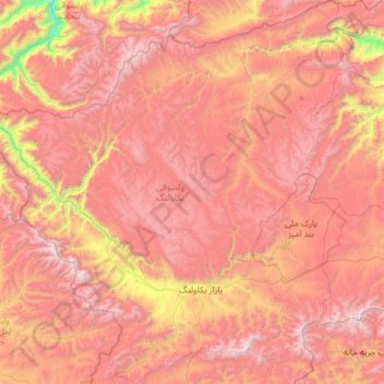
Nom : Carte topographique Yakawlang, altitude, relief.
Lieu : Yakawlang, Bamyan Province, Afghanistan (34.49217 66.27695 35.46654 67.44378)
Altitude moyenne : 3’273 m
Altitude minimum : 1’587 m
Altitude maximum : 4’621 m
Yakawlang (Persian: یکاولنگ) is district located in the northwestern part of Bamyan Province. Its population is 76,897 (2011) predominantly from the Hazara ethnic group. The capital city Yakawlang (altitude 2714m) formerly held 60,000 residents, and it was destroyed by Taliban forces in 2001. Massacres of civilians by the Taliban were reported by Human Rights groups.There is a gravel surfaced airport near the city.
Autres cartes topographiques
Cliquez sur une carte pour visualiser sa topographie, son altitude et son relief.