
Carte topographique Eppenbrunn
Carte interactive
Cliquez sur la carte pour afficher l’altitude.
À propos de cette carte
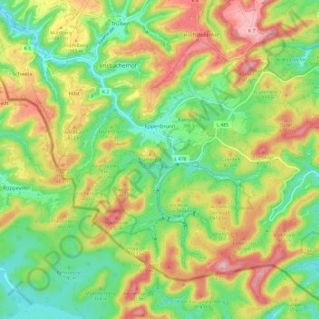
Nom : Carte topographique Eppenbrunn, altitude, relief.
Altitude moyenne : 348 m
Altitude minimum : 260 m
Altitude maximum : 466 m
Autres cartes topographiques
Cliquez sur une carte pour visualiser sa topographie, son altitude et son relief.
Waldfischbach-Burgalben
Germany > Rhineland-Palatinate > Südwestpfalz
Waldfischbach-Burgalben, Südwestpfalz, Rhineland-Palatinate, 67714, Germany
Altitude moyenne : 340 m
Fischbach bei Dahn
Germany > Rhineland-Palatinate > Südwestpfalz > Fischbach bei Dahn
Fischbach bei Dahn, Dahner Felsenland, Südwestpfalz, Rhineland-Palatinate, 66996, Germany
Altitude moyenne : 308 m