
Carte topographique Khash Rod
Carte interactive
Cliquez sur la carte pour afficher l’altitude.
À propos de cette carte
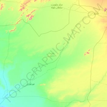
Nom : Carte topographique Khash Rod, altitude, relief.
Lieu : Khash Rod, Nimruz Province, Afghanistan (31.25093 62.30434 32.25679 63.58947)
Altitude moyenne : 693 m
Altitude minimum : 491 m
Altitude maximum : 1’545 m
Autres cartes topographiques
Cliquez sur une carte pour visualiser sa topographie, son altitude et son relief.
Kamal Khan Dam
Afghanistan > Nimruz Province > Chahar Burjak
Kamal Khan Dam, Chahar Burjak, Nimruz Province, Afghanistan
Altitude moyenne : 517 m
Chahar Burjak
Chahar Burjak, Nimruz Province, Afghanistan
Altitude moyenne : 672 m