
Carte topographique Carrig Bridge
Carte interactive
Cliquez sur la carte pour afficher l’altitude.
À propos de cette carte
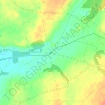
Nom : Carte topographique Carrig Bridge, altitude, relief.
Altitude moyenne : 84 m
Altitude minimum : 62 m
Altitude maximum : 107 m
Autres cartes topographiques
Cliquez sur une carte pour visualiser sa topographie, son altitude et son relief.
Kinnity
Ireland > County Offaly > The Municipal District of Birr
Kinnity, The Municipal District of Birr, County Offaly, Leinster, Ireland
Altitude moyenne : 251 m
Shinrone
Ireland > County Offaly > The Municipal District of Birr > Shinrone
Shinrone, The Municipal District of Birr, County Offaly, Leinster, Ireland
Altitude moyenne : 72 m