
Carte topographique Aderstedt
Carte interactive
Cliquez sur la carte pour afficher l’altitude.
À propos de cette carte
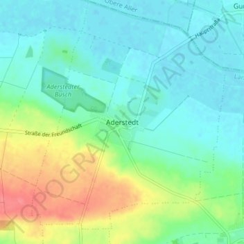
Nom : Carte topographique Aderstedt, altitude, relief.
Altitude moyenne : 98 m
Altitude minimum : 79 m
Altitude maximum : 145 m
Autres cartes topographiques
Cliquez sur une carte pour visualiser sa topographie, son altitude et son relief.
Schlanstedt
Deutschland > Sachsen-Anhalt > Landkreis Harz > Huy
Schlanstedt, Huy, Landkreis Harz, Sachsen-Anhalt, 38838, Deutschland
Altitude moyenne : 98 m
Eilsdorf
Deutschland > Sachsen-Anhalt > Landkreis Harz > Huy
Eilsdorf, Huy, Landkreis Harz, Sachsen-Anhalt, 38838, Deutschland
Altitude moyenne : 118 m
Badersleben
Deutschland > Sachsen-Anhalt > Landkreis Harz > Huy > Badersleben
Badersleben, Huy, Landkreis Harz, Sachsen-Anhalt, 38836, Deutschland
Altitude moyenne : 179 m