
Carte topographique Lar
Cliquez sur la carte pour afficher l’altitude.
À propos de cette carte
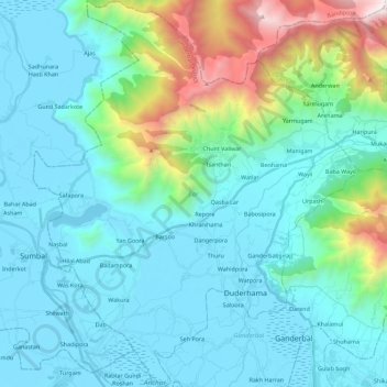
Nom : Carte topographique Lar, altitude, relief.
Lieu : Lar, Ganderbal District, Jammu and Kashmir, 191131, India (34.16772 74.64450 34.36413 74.83421)
Altitude moyenne : 2’024 m
Altitude minimum : 1’576 m
Altitude maximum : 4’191 m
Autres cartes topographiques
Cliquez sur une carte pour visualiser sa topographie, son altitude et son relief.