

Carte topographique Haldwani
Cliquez sur la carte pour afficher l’altitude.
Haldwani
Haldwani is located at 29°13′N 79°31′E / 29.22°N 79.52°E / 29.22; 79.52, in the Nainital district on the right bank of the Gaula River. Geologically, Haldwani is settled on a piedmont grade (called Bhabhar) where the mountain rivers go underground to re-emerge in the Indo-Gangetic plain. The Haldwani Bhabhar stretches horizontally, surrounded by the regions of Ramnagar and Tanakpur and lies between the Shivalik hills to the north and the Terai region of Rudrapur to the south. The average land elevation is 424 m (1,391 ft) above sea level. According to the Bureau of Indian Standards, haldwani falls under seismic zone 4, in a scale of 2 to 5 (in order of increasing vulnerability to earthquakes).: 27
À propos de cette carte
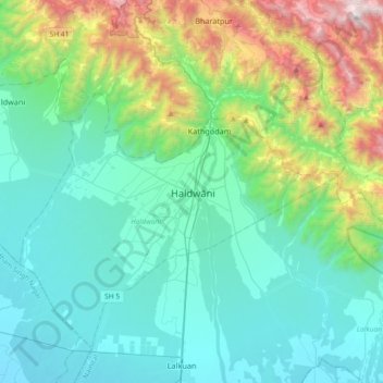
Nom : Carte topographique Haldwani, altitude, relief.
Lieu : Haldwani, Nainital, Uttarakhand, 263139, India (29.05446 79.36792 29.37446 79.68792)
Altitude moyenne : 673 m
Altitude minimum : 222 m
Altitude maximum : 2’400 m