
Carte topographique Fuquay-Varina
Carte interactive
Cliquez sur la carte pour afficher l’altitude.
À propos de cette carte
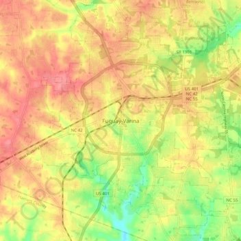
Nom : Carte topographique Fuquay-Varina, altitude, relief.
Altitude moyenne : 120 m
Altitude minimum : 75 m
Altitude maximum : 150 m
Fuquay-Varina is located in the northeast central region of North Carolina, where the North American Piedmont and Atlantic Coastal Plain regions meet. This area is known as the "Fall Line" because it marks the elevation inland at which waterfalls begin to appear in creeks and rivers. Its central Piedmont location situates Fuquay-Varina about three hours west of Atlantic Beach, North Carolina, by car and four hours east of the Great Smoky Mountains.