Géolocaliser

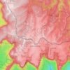
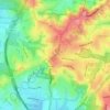
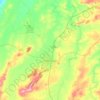
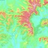
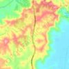
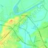
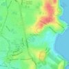
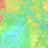
Carte topographique Broughton

Cliquez sur la carte pour afficher l’altitude.

À propos de cette carte

Nom : Carte topographique Broughton, altitude, relief.

Lieu : Broughton, Shoalhaven City Council, New South Wales, 2535, Australia (-34.73233 150.67615 -34.73223 150.67625)

Altitude moyenne : 320 m

Altitude minimum : 77 m

Altitude maximum : 576 m

Autres cartes topographiques

Cliquez sur une carte pour visualiser sa topographie, son altitude et son relief.
Sydney

Australia > New South Wales

Sydney's topography is characterized by a diverse landscape that seamlessly blends coastal features with inland plateaus. The city is divided into two primary regions: the relatively flat Cumberland Plain to the south and west of Sydney Harbour, and the elevated Hornsby Plateau to the north. The Cumberland…

Altitude moyenne : 51 m
Newcastle

Australia > New South Wales > Newcastle

Altitude moyenne : 5 m

Karangi

Australia > New South Wales

Altitude moyenne : 173 m

Sydney

Australia > New South Wales > Sydney

Altitude moyenne : 23 m

Central Coast Council

Australia > New South Wales

Altitude moyenne : 103 m

Port Macquarie

Australia > New South Wales

Altitude moyenne : 5 m

Wentworth Falls

Australia > New South Wales > Sydney

Wentworth Falls (postcode: 2782) is a town in the Blue Mountains region of New South Wales, situated approximately 100 kilometres (62 mi) west of the Sydney central business district, and about 8 kilometres (5.0 mi) east of Katoomba, Australia on the Great Western Highway, with a Wentworth Falls railway…

Altitude moyenne : 708 m

Moruya

Australia > New South Wales

Altitude moyenne : 37 m

Katoomba

Australia > New South Wales

Altitude moyenne : 904 m

Byron Bay

Australia > New South Wales

Byron Bay, located in northeastern New South Wales, Australia, is characterized by diverse topography shaped by its geological history. The town is part of the erosion caldera of the ancient Tweed Volcano, which erupted approximately 23 million years ago, resulting in the rich volcanic soils that define the…

Altitude moyenne : 7 m
Lithgow City Council

Australia > New South Wales

Altitude moyenne : 713 m

St Ives

Australia > New South Wales > Sydney

Altitude moyenne : 125 m

Wollemi National Park

Australia > New South Wales

Altitude moyenne : 521 m

Barrington Tops

Australia > New South Wales

Altitude moyenne : 1’107 m

Charlestown

Australia > New South Wales

Altitude moyenne : 71 m

Bowral

Australia > New South Wales

Altitude moyenne : 690 m

East Branxton

Australia > New South Wales

Altitude moyenne : 50 m

Kangaroo Valley

Australia > New South Wales

Altitude moyenne : 320 m

Paxton

Australia > New South Wales

Altitude moyenne : 125 m

Scotts Head

Australia > New South Wales

Altitude moyenne : 5 m

Robertson

Australia > New South Wales

Altitude moyenne : 545 m

Clarence Town

Australia > New South Wales

Altitude moyenne : 62 m

Wootton

Australia > New South Wales

Altitude moyenne : 102 m

Berry Mountain

Australia > New South Wales

Altitude moyenne : 216 m

Glen Innes

Australia > New South Wales

Altitude moyenne : 1’083 m

Manly

Australia > New South Wales

Altitude moyenne : 17 m

West Pennant Hills

Australia > New South Wales

Altitude moyenne : 130 m

Sawyers Gully

Australia > New South Wales

Altitude moyenne : 56 m

Penrith

Australia > New South Wales > Sydney > Penrith

Penrith is a city in New South Wales, Australia, located in Greater Western Sydney, 55 kilometres (31 mi) west of the Sydney central business district on the banks of the Nepean River, on the outskirts of the Cumberland Plain. Its elevation is 32 metres (105 ft).

Altitude moyenne : 34 m

Eastwood

Australia > New South Wales > Sydney

Altitude moyenne : 80 m

Wauchope

Australia > New South Wales

Altitude moyenne : 32 m

Kalkite

Australia > New South Wales

Altitude moyenne : 1’053 m

Inner West

Australia > New South Wales > Sydney

Altitude moyenne : 19 m

Bexhill

Australia > New South Wales

Altitude moyenne : 34 m

Lake Canobolas

Australia > New South Wales

Altitude moyenne : 937 m

Burramoko Ridge

Australia > New South Wales

Altitude moyenne : 920 m

Gibraltar Range

Australia > New South Wales

Altitude moyenne : 686 m

Mittagong

Australia > New South Wales

Altitude moyenne : 672 m

Mullumbimby

Australia > New South Wales

Altitude moyenne : 29 m

Brindabella

Australia > New South Wales

Altitude moyenne : 970 m

Bonny Hills

Australia > New South Wales

Altitude moyenne : 15 m

Nimbin

Australia > New South Wales

Altitude moyenne : 235 m

Ocean Shores

Australia > New South Wales

Altitude moyenne : 12 m

Hawkesbury River

Australia > New South Wales

Altitude moyenne : 130 m

Kempsey Shire Council

Australia > New South Wales

Altitude moyenne : 372 m

Tintenbar

Australia > New South Wales

Altitude moyenne : 49 m

Orange

Australia > New South Wales

Orange is a city in the Central Tablelands region of New South Wales, Australia. It is 254 km (158 mi) west of the state capital, Sydney [206 km (128 mi) on a great circle], at an altitude of 862 metres (2,828 ft). Orange had an estimated urban population of 40,493 as of June 2018 making the city a significant…

Altitude moyenne : 852 m

Kurrajong

Australia > New South Wales

Altitude moyenne : 244 m

Dubbo

Australia > New South Wales

Altitude moyenne : 318 m

Newrybar

Australia > New South Wales

Altitude moyenne : 81 m

Sunny Corner

Australia > New South Wales

Altitude moyenne : 1’119 m

Bilambil Heights

Australia > New South Wales

Altitude moyenne : 41 m

Nowendoc

Australia > New South Wales

Altitude moyenne : 869 m

Kelso

Australia > New South Wales

Altitude moyenne : 696 m

Eucumbene

Australia > New South Wales

Altitude moyenne : 1’182 m

Laguna

Australia > New South Wales

Altitude moyenne : 228 m

Kiandra

Australia > New South Wales

Altitude moyenne : 1’432 m

Goulburn

Australia > New South Wales

Owing to its elevation, Goulburn has an oceanic climate (Cfb) with warm summers and cool winters; with a high diurnal range. Its climate is variable much of the year, though generally dry with maximum temperatures ranging from 11.8 °C (53.2 °F) in July to 28.3 °C (82.9 °F) in January. Rainfall is…

Altitude moyenne : 666 m

Nowra

Australia > New South Wales

Altitude moyenne : 21 m

Windsor

Australia > New South Wales

Altitude moyenne : 12 m

Taree

Australia > New South Wales

Altitude moyenne : 17 m

Newnes Plateau

Australia > New South Wales

Altitude moyenne : 889 m

Macquarie River

Australia > New South Wales

Altitude moyenne : 139 m

Erina

Australia > New South Wales

Altitude moyenne : 46 m

Guthega

Australia > New South Wales

Altitude moyenne : 1’743 m

Wagga Wagga

Australia > New South Wales

Altitude moyenne : 183 m

Lismore

Australia > New South Wales

Altitude moyenne : 23 m

Cooma

Australia > New South Wales

Altitude moyenne : 869 m

Blue Mountains

Australia > New South Wales

A sandstone plateau dominated by a landscape of endless eucalyptus forests, the Blue Mountains are located at the top of a 470-million-year-old quartzite. In the Permian period, a shallow sea covered the region, when rivers brought shales, siltstones and mudstones. Then during the Mesozoic period, rivers…

Altitude moyenne : 566 m

Thalgarrah

Australia > New South Wales

Altitude moyenne : 1’116 m

Narrandera

Australia > New South Wales

Altitude moyenne : 164 m

Berry

Australia > New South Wales

Altitude moyenne : 38 m

Glenbrook

Australia > New South Wales

Altitude moyenne : 168 m

Bellmount Forest

Australia > New South Wales

Altitude moyenne : 658 m

Parramatta

Australia > New South Wales

Altitude moyenne : 22 m

Armidale

Australia > New South Wales

Altitude moyenne : 1’036 m

Greystanes

Australia > New South Wales > Sydney

Altitude moyenne : 53 m

Cammeray

Australia > New South Wales > Sydney

Prior to the 1920s, the suburb was known as Suspension Bridge reflecting the now Long Gully Bridge that joined Northbridge to Cammeray. Cammeray was slow to develop mainly due to its steep topography and remoteness from transport.

Altitude moyenne : 66 m

Redfern

Australia > New South Wales

Altitude moyenne : 30 m

Wolli Creek

Australia > New South Wales > Sydney

Altitude moyenne : 27 m

Leura

Australia > New South Wales

Leura's elevation of 985 metres (3,232 ft) AHD  leads to occasional snowfall in winter and a climate that reflects all four seasons distinctly.

Altitude moyenne : 880 m

Kurnell

Australia > New South Wales > Sydney

Altitude moyenne : 4 m

Mount Pritchard

Australia > New South Wales > Sydney

Altitude moyenne : 34 m
Mount Druitt

Australia > New South Wales > Sydney

Altitude moyenne : 52 m

Mudgee

Australia > New South Wales

Altitude moyenne : 535 m

Coogee

Australia > New South Wales

Altitude moyenne : 35 m

Maroubra

Australia > New South Wales

Altitude moyenne : 27 m

Tyalgum

Australia > New South Wales

Altitude moyenne : 161 m

Équipez-vous pour votre prochaine aventure :

🕶️Cordon pour lunettes - Ne perdez plus vos lunettes lors de vos mouvements brusques
🧢Bonnets en laine mérinos - Chaleur naturelle
📍Balises GPS - Suivi et sécurité
🏕️Tentes de randonnée - Tentes légères pour bivouac et trekking
🌧️Poncho imperméable - Protection rapide et efficace contre les averses soudaines en montagne

En tant que Partenaire Amazon, ce site perçoit une commission sur les achats éligibles sans surcoût pour vous.