
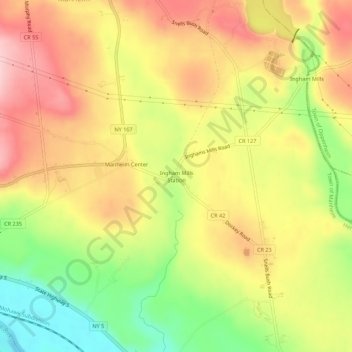
Carte topographique Ingham Mills Station
Carte interactive
Cliquez sur la carte pour afficher l’altitude.
À propos de cette carte
Nom : Carte topographique Ingham Mills Station, altitude, relief.
Altitude moyenne : 189 m
Altitude minimum : 87 m
Altitude maximum : 272 m
Autres cartes topographiques
Cliquez sur une carte pour visualiser sa topographie, son altitude et son relief.
East Creek
United States > New York > Herkimer County > Town of Manheim
East Creek, Town of Manheim, Herkimer County, New York, United States
Altitude moyenne : 139 m
Ingham Mills
United States > New York > Herkimer County > Town of Manheim
Ingham Mills, Town of Manheim, Herkimer County, New York, 13329, United States
Altitude moyenne : 215 m
Manheim Center
United States > New York > Herkimer County > Town of Manheim
Manheim Center, Town of Manheim, Herkimer County, New York, United States
Altitude moyenne : 196 m