
Carte topographique Hoodoo Mountain
Carte interactive
Cliquez sur la carte pour afficher l’altitude.
À propos de cette carte
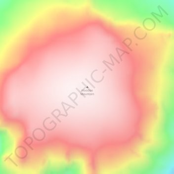
Nom : Carte topographique Hoodoo Mountain, altitude, relief.
Altitude moyenne : 1’657 m
Altitude minimum : 1’182 m
Altitude maximum : 1’855 m
Hoodoo Mountain, sometimes referred to as Hoodoo Volcano, is a potentially active stratovolcano in the Northern Interior of British Columbia, Canada. It is located 25 kilometres (16 miles) northeast of the Alaska–British Columbia border on the north side of the Iskut River opposite of the mouth of the Craig River. With a summit elevation of 1,850 metres (6,070 feet) and a topographic prominence of 900 metres (3,000 feet), Hoodoo Mountain is one of many prominent peaks within the Boundary Ranges of the Coast Mountains. Its flat-topped summit is covered by an ice cap more than 100 metres (330 feet) thick and at least 3 kilometres (1.9 miles) in diameter. Two valley glaciers surrounding the northwestern and northeastern sides of the mountain have retreated significantly over the last hundred years. They both originate from a large icefield to the north and are the sources of two meltwater streams. These streams flow along the western and eastern sides of the volcano before draining into the Iskut River.
Autres cartes topographiques
Cliquez sur une carte pour visualiser sa topographie, son altitude et son relief.
Tumeka Lake
Canada > British Columbia > Regional District of Kitimat-Stikine > Area D (Iskut/Big Raven)
Tumeka Lake, Area D (Iskut/Big Raven), Regional District of Kitimat-Stikine, British Columbia, Canada
Altitude moyenne : 1’382 m
Bob Quinn Lake
Canada > British Columbia > Regional District of Kitimat-Stikine > Area D (Iskut/Big Raven)
Bob Quinn Lake, Area D (Iskut/Big Raven), Regional District of Kitimat-Stikine, British Columbia, Canada
Altitude moyenne : 585 m
Iskut River
Canada > British Columbia > Regional District of Kitimat-Stikine > Area D (Iskut/Big Raven)
Iskut River, Area D (Iskut/Big Raven), Regional District of Kitimat-Stikine, British Columbia, V0J 1K0, Canada
Altitude moyenne : 932 m
Mount Edziza
Canada > British Columbia > Regional District of Kitimat-Stikine > Area D (Iskut/Big Raven)
Mount Edziza, Area D (Iskut/Big Raven), Regional District of Kitimat-Stikine, British Columbia, Canada
Altitude moyenne : 2’530 m