
Carte topographique Strathclyde Park
Cliquez sur la carte pour afficher l’altitude.
À propos de cette carte
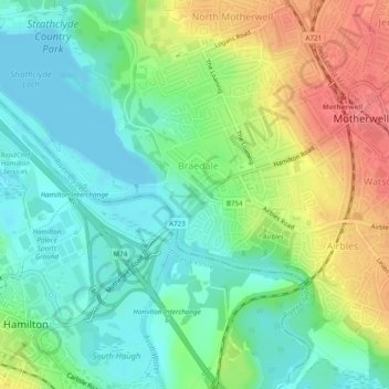
Nom : Carte topographique Strathclyde Park, altitude, relief.
Altitude moyenne : 44 m
Altitude minimum : 18 m
Altitude maximum : 86 m
Autres cartes topographiques
Cliquez sur une carte pour visualiser sa topographie, son altitude et son relief.
Barons Haugh Nature Reserve
United Kingdom > Scotland > North Lanarkshire > Motherwell
Altitude moyenne : 52 m