
Carte topographique Woodland Park
Carte interactive
Cliquez sur la carte pour afficher l’altitude.
À propos de cette carte
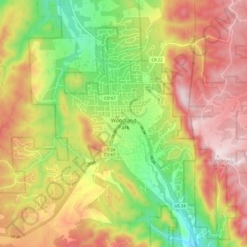
Nom : Carte topographique Woodland Park, altitude, relief.
Altitude moyenne : 2’657 m
Altitude minimum : 2’419 m
Altitude maximum : 2’884 m
Woodland Park experiences an alpine subarctic climate (Dfc), due to its high elevation and its location in the Rocky Mountains. Summers are warm, but much milder than summers at lower elevations, such as in Colorado Springs, Denver, or the plains to the east. Nights are cool, even chilly in summer.