
Carte topographique Hillary Step
Carte interactive
Cliquez sur la carte pour afficher l’altitude.
À propos de cette carte
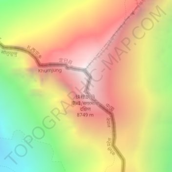
Nom : Carte topographique Hillary Step, altitude, relief.
Altitude moyenne : 7’824 m
Altitude minimum : 6’597 m
Altitude maximum : 8’849 m
The step was named after Sir Edmund Hillary, who was the first known person, along with Tenzing Norgay, to scale it on the way to the summit during the 1953 British Mount Everest Expedition. Hillary and Tenzing first climbed the Hillary Step on 29 May 1953 by climbing the crack between the snow and the rock. Hillary reported that the snow on the step was harder than at lower elevation. Hillary wrote in 1953:
Autres cartes topographiques
Cliquez sur une carte pour visualiser sa topographie, son altitude et son relief.
Mount Everest
Nepal > Koshi Province > Solukhumbu
Mount Everest, Khumbupasanglahmu, Solukhumbu, Koshi Province, Nepal
Altitude moyenne : 7’850 m
Himalayas
Nepal > Koshi Province > Solukhumbu
Himalayas, Khumbupasanglahmu, Solukhumbu, Koshi Province, Nepal
Altitude moyenne : 7’555 m
Gonbo
Nepal > Koshi Province > Solukhumbu
Gonbo, Solududhkunda, Solukhumbu, Koshi Province, Nepal
Altitude moyenne : 3’030 m
Mount Everest
Nepal > Koshi Province > Solukhumbu
Mount Everest, Khumbupasanglahmu, Solukhumbu, Koshi Province, Nepal
Altitude moyenne : 7’847 m
Phaplu
Nepal > Koshi Province > Solukhumbu
Phaplu, Solududhkunda, Solukhumbu, Koshi Province, 50600, Nepal
Altitude moyenne : 2’518 m
Khumjung
Nepal > Koshi Province > Solukhumbu
Khumjung, Khumbupasanglahmu, Solukhumbu, Koshi Province, 56002, Nepal
Altitude moyenne : 3’888 m
Gorak Shep
Nepal > Koshi Province > Solukhumbu
Gorak Shep, Khumbupasanglahmu-04, Khumbupasanglahmu, Solukhumbu, Koshi Province, Nepal
Altitude moyenne : 5’255 m
Sanasa
Nepal > Koshi Province > Solukhumbu > Khumjung
Sanasa, Khumbupasanglahmu-04, Khumjung, Khumbupasanglahmu, Solukhumbu, Koshi Province, 56002, Nepal
Altitude moyenne : 3’815 m
Lobuche
Nepal > Koshi Province > Solukhumbu
Lobuche, Khumbupasanglahmu-04, Khumbupasanglahmu, Solukhumbu, Koshi Province, Nepal
Altitude moyenne : 5’118 m
Lukla
Nepal > Koshi Province > Solukhumbu
Lukla, Khumbupasanglahmu, Solukhumbu, Koshi Province, Nepal
Altitude moyenne : 2’996 m
Ama Dablam
Nepal > Koshi Province > Solukhumbu
Ama Dablam, Khumbupasanglahmu, Solukhumbu, Koshi Province, Nepal
Altitude moyenne : 5’625 m
Namche Bazaar
Nepal > Koshi Province > Solukhumbu
Namche Bazaar, Khumbupasanglahmu, Solukhumbu, Koshi Province, 56002, Nepal
Altitude moyenne : 3’526 m