

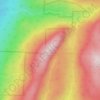
Carte topographique West Rutland
Cliquez sur la carte pour afficher l’altitude.
West Rutland
The town of Rutland was originally granted in 1761 as one of the New Hampshire Grants and named after Rutland, Massachusetts, the home of the first grantee, John Murrey. It was one of the most successful of those grants because of excellent farmland and gentle topography.
À propos de cette carte

Nom : Carte topographique West Rutland, altitude, relief.
Lieu : West Rutland, Rutland County, Vermont, 05777, United States (43.57019 -73.10454 43.66511 -73.00953)
Altitude moyenne : 268 m
Altitude minimum : 110 m
Altitude maximum : 713 m
Autres cartes topographiques
Cliquez sur une carte pour visualiser sa topographie, son altitude et son relief.

Brookside Trailer Park
United States > Vermont > Rutland County > Rutland City
Altitude moyenne : 198 m







Billings Mobile Manor
United States > Vermont > Rutland County > Rutland City
Altitude moyenne : 211 m
West Tinmouth
United States > Vermont > Rutland County > Tinmouth > West Tinmouth
Altitude moyenne : 419 m