
Carte topographique Darreh-ye Galleh Cheshmeh;Darrah-i-Gala Casma;Darah-ye Galah Chashmah
Carte interactive
Cliquez sur la carte pour afficher l’altitude.
À propos de cette carte
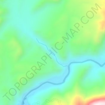
Nom : Carte topographique Darreh-ye Galleh Cheshmeh;Darrah-i-Gala Casma;Darah-ye Galah Chashmah, altitude, relief.
Altitude moyenne : 816 m
Altitude minimum : 640 m
Altitude maximum : 1’289 m
Autres cartes topographiques
Cliquez sur une carte pour visualiser sa topographie, son altitude et son relief.