
Carte topographique Darranstown
Cliquez sur la carte pour afficher l’altitude.
À propos de cette carte
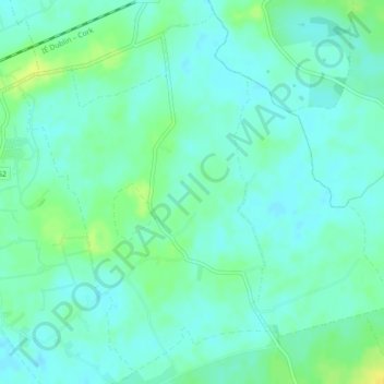
Nom : Carte topographique Darranstown, altitude, relief.
Altitude moyenne : 108 m
Altitude minimum : 101 m
Altitude maximum : 121 m
Autres cartes topographiques
Cliquez sur une carte pour visualiser sa topographie, son altitude et son relief.
Kilcruaig
Ireland > County Limerick > The Municipal District of Cappamore — Kilmallock
Altitude moyenne : 200 m
Knockadea
Ireland > County Limerick > The Municipal District of Cappamore — Kilmallock
Altitude moyenne : 203 m
Pallasgreen
Ireland > County Limerick > The Municipal District of Cappamore — Kilmallock
Altitude moyenne : 72 m
Galtymore
Ireland > County Limerick > The Municipal District of Cappamore — Kilmallock
Galtymore or Galteemore (Irish: Cnoc Mór na nGaibhlte, meaning 'big hill of the Galtees') is a mountain in the province of Munster, Ireland. At 917.9 metres (3,011 ft 6 in), it is one of Ireland's highest mountains, being the 12th-highest on the Arderin list, and 14th-highest on the Vandeleur-Lynam list.…
Altitude moyenne : 594 m
Aherlow
Ireland > County Limerick > The Municipal District of Cappamore — Kilmallock
Altitude moyenne : 141 m
Clare Glens
Ireland > County Limerick > The Municipal District of Cappamore — Kilmallock
Altitude moyenne : 124 m
Ardpatrick
Ireland > County Limerick > The Municipal District of Cappamore — Kilmallock
Altitude moyenne : 169 m
Bruff
Ireland > County Limerick > The Municipal District of Cappamore — Kilmallock
Altitude moyenne : 68 m
Bruree
Ireland > County Limerick > The Municipal District of Cappamore — Kilmallock
Altitude moyenne : 62 m