
Carte topographique Ball Ground
Carte interactive
Cliquez sur la carte pour afficher l’altitude.
À propos de cette carte
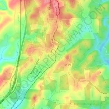
Nom : Carte topographique Ball Ground, altitude, relief.
Lieu : Ball Ground, Cherokee County, Georgia, 30107, United States (34.31823 -84.39657 34.35823 -84.35657)
Altitude moyenne : 332 m
Altitude minimum : 281 m
Altitude maximum : 383 m
According to the United States Census Bureau, the city has a total area of 5.8 square miles (15.1 km2), of which 0.031 square miles (0.08 km2), or 0.50%, is water. The city's elevation averages around 1,100 feet (340 m) above sea level, ranging from just over 1,000 feet (300 m) in the valleys to around 1,200 feet (370 m) on several hilltops within the city.