
Carte topographique Powell County
Carte interactive
Cliquez sur la carte pour afficher l’altitude.
À propos de cette carte
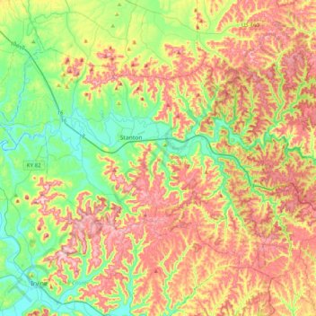
Nom : Carte topographique Powell County, altitude, relief.
Lieu : Powell County, Kentucky, United States of America (37.71611 -84.02782 37.93375 -83.63126)
Altitude moyenne : 293 m
Altitude minimum : 177 m
Altitude maximum : 442 m
Autres cartes topographiques
Cliquez sur une carte pour visualiser sa topographie, son altitude et son relief.
Williamstown
United States of America > Kentucky > Williamstown
Williamstown, Grant County, Kentucky, 41097, United States of America
Altitude moyenne : 262 m
Cumberland County
United States of America > Kentucky
Cumberland County, Kentucky, United States of America
Altitude moyenne : 237 m
Edmonson County
United States of America > Kentucky
Edmonson County, Kentucky, United States of America
Altitude moyenne : 196 m