Géolocaliser

Carte topographique Aru

Carte interactive

Cliquez sur la carte pour afficher l’altitude.

À propos de cette carte

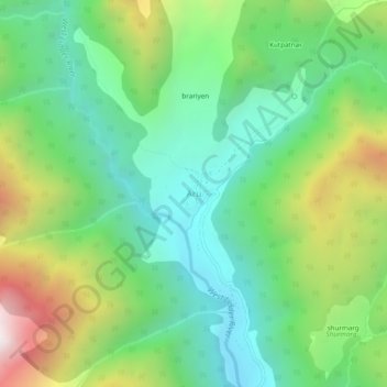
Nom : Carte topographique Aru, altitude, relief.

Lieu : Aru, Pahalgam, Anantnag District, Jammu and Kashmir, India (34.07030 75.24244 34.11030 75.28244)

Altitude moyenne : 2’764 m

Altitude minimum : 2’305 m

Altitude maximum : 3’691 m

Autres cartes topographiques

Cliquez sur une carte pour visualiser sa topographie, son altitude et son relief.

lidru

India > Jammu and Kashmir > Pahalgam

lidru, Pahalgam, Anantnag District, Jammu and Kashmir, India

Altitude moyenne : 2’398 m

kolur

India > Jammu and Kashmir > Pahalgam

kolur, Pahalgam, Anantnag District, Jammu and Kashmir, India

Altitude moyenne : 2’017 m

Panchtarni

India > Jammu and Kashmir > Pahalgam

Panchtarni, Pahalgam, Anantnag District, Jammu and Kashmir, India

Altitude moyenne : 3’899 m