
Carte topographique As Touzas da Azoreira
Carte interactive
Cliquez sur la carte pour afficher l’altitude.
À propos de cette carte
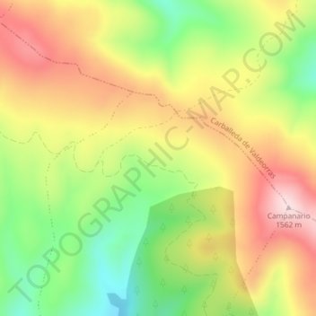
Nom : Carte topographique As Touzas da Azoreira, altitude, relief.
Altitude moyenne : 1’398 m
Altitude minimum : 1’234 m
Altitude maximum : 1’559 m
Autres cartes topographiques
Cliquez sur une carte pour visualiser sa topographie, son altitude et son relief.
Meixide
España > Galicia > Valdeorras > La Vega
Meixide, La Vega, Valdeorras, Orense, Galicia, 32366, España
Altitude moyenne : 1’171 m
Lamalonga
España > Galicia > Valdeorras > La Vega
Lamalonga, La Vega, Valdeorras, Orense, Galicia, 32366, España
Altitude moyenne : 1’205 m