
Carte topographique Malayer
Carte interactive
Cliquez sur la carte pour afficher l’altitude.
À propos de cette carte
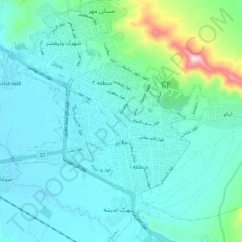
Nom : Carte topographique Malayer, altitude, relief.
Altitude moyenne : 1’809 m
Altitude minimum : 1’718 m
Altitude maximum : 2’308 m
Autres cartes topographiques
Cliquez sur une carte pour visualiser sa topographie, son altitude et son relief.
Shush Ab
Iran > Hamadan Province > Malayer County > Haram Rud-e Olya
Shush Ab, Haram Rud-e Olya, Central District, Malayer County, Hamadan Province, Iran
Altitude moyenne : 1’677 m
Kosar tourist resorts
Iran > Hamadan Province > Malayer County > Malayer
Kosar tourist resorts, شهرک ولیعصر, Malayer, Central District, Malayer County, Hamadan Province, Iran
Altitude moyenne : 1’755 m