
Carte topographique Schunnemunk State Park
Carte interactive
Cliquez sur la carte pour afficher l’altitude.
À propos de cette carte
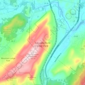
Nom : Carte topographique Schunnemunk State Park, altitude, relief.
Altitude moyenne : 213 m
Altitude minimum : 66 m
Altitude maximum : 506 m
Autres cartes topographiques
Cliquez sur une carte pour visualiser sa topographie, son altitude et son relief.
Highland Mills
United States > New York > Orange County > Village of Woodbury
Highland Mills, Village of Woodbury, Town of Woodbury, Orange County, New York, 10930, United States
Altitude moyenne : 208 m
Central Valley
United States > New York > Orange County > Village of Woodbury
Central Valley, Village of Woodbury, Town of Woodbury, Orange County, New York, 10917, United States
Altitude moyenne : 205 m