
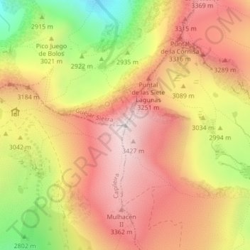
Carte topographique Pico de Mulhacén
Carte interactive
Cliquez sur la carte pour afficher l’altitude.
À propos de cette carte
Nom : Carte topographique Pico de Mulhacén, altitude, relief.
Altitude moyenne : 3’070 m
Altitude minimum : 2’489 m
Altitude maximum : 3’473 m
Mulhacén ([mulaˈθen]), with an elevation of 3,482 metres (11,424 ft), is the highest mountain in peninsular Spain and in all of the Iberian Peninsula. It is part of the Sierra Nevada range in the Penibaetic System. It is named after Abu'l-Hasan Ali, known as Muley Hacén in Spanish, the penultimate Muslim ruler of Granada in the 15th century who, according to legend, was buried on the summit of the mountain.