
Carte topographique Bad Dürkheim
Carte interactive
Cliquez sur la carte pour afficher l’altitude.
À propos de cette carte
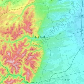
Nom : Carte topographique Bad Dürkheim, altitude, relief.
Altitude moyenne : 216 m
Altitude minimum : 92 m
Altitude maximum : 562 m
Autres cartes topographiques
Cliquez sur une carte pour visualiser sa topographie, son altitude et son relief.
Wachenheim an der Weinstraße
Germany > Rhineland-Palatinate > Landkreis Bad Dürkheim
Wachenheim an der Weinstraße, Landkreis Bad Dürkheim, Rhineland-Palatinate, 67157, Germany
Altitude moyenne : 202 m