Géolocaliser

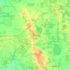
Carte topographique Lake Bonny

Cliquez sur la carte pour afficher l’altitude.

À propos de cette carte

Nom : Carte topographique Lake Bonny, altitude, relief.

Lieu : Lake Bonny, Lakeland, Polk County, Florida, United States (28.02903 -81.93435 28.04563 -81.91917)

Altitude moyenne : 45 m

Altitude minimum : 35 m

Altitude maximum : 55 m

Autres cartes topographiques

Cliquez sur une carte pour visualiser sa topographie, son altitude et son relief.
Fountain Heights

United States > Florida > Polk County > Lakeland

Altitude moyenne : 53 m

Lakeland

United States > Florida > Polk County > Lakeland

Altitude moyenne : 42 m

Fountain Heights

United States > Florida > Polk County > Lakeland

Altitude moyenne : 53 m

Équipez-vous pour votre prochaine aventure :

🧤Gants de randonnée - Gants chauds ou respirants pour conditions changeantes
🕶️Lunettes de soleil montagne - Protection UV en altitude
🔦Lampe frontale LED - Éclairage mains libres indispensable pour les départs à l'aube
🛠️Outils multifonctions - Réparations et usages polyvalents
🍽️Popotes de camping - Ustensiles légers pour repas en bivouac

En tant que Partenaire Amazon, ce site perçoit une commission sur les achats éligibles sans surcoût pour vous.