
Carte topographique Thanöd
Carte interactive
Cliquez sur la carte pour afficher l’altitude.
À propos de cette carte
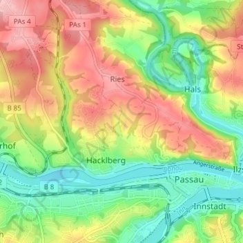
Nom : Carte topographique Thanöd, altitude, relief.
Lieu : Thanöd, Passau, Bayern, 94034, Deutschland (48.56432 13.42403 48.60432 13.46403)
Altitude moyenne : 358 m
Altitude minimum : 287 m
Altitude maximum : 443 m
Autres cartes topographiques
Cliquez sur une carte pour visualiser sa topographie, son altitude et son relief.
Passau
Deutschland > Bayern > Passau
Passau, Niederbayern, Bayern, 94032, Deutschland
Altitude moyenne : 380 m
Ries
Deutschland > Bayern > Passau > Ries
Ries, Passau, Bayern, 94034, Deutschland
Altitude moyenne : 366 m
Patriching
Deutschland > Bayern > Passau > Patriching
Patriching, Passau, Bayern, 94113, Deutschland
Altitude moyenne : 387 m
Jägerhof
Deutschland > Bayern > Passau
Jägerhof, Passau, Bayern, 94031, Deutschland
Altitude moyenne : 351 m