
Carte topographique Hernio
Carte interactive
Cliquez sur la carte pour afficher l’altitude.
À propos de cette carte
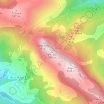
Nom : Carte topographique Hernio, altitude, relief.
Altitude moyenne : 707 m
Altitude minimum : 257 m
Altitude maximum : 1’051 m
Autres cartes topographiques
Cliquez sur une carte pour visualiser sa topographie, son altitude et son relief.
Año
España > País Vasco > Albístur
Año, Albístur, Guipúzcoa, País Vasco, 20150, España
Altitude moyenne : 507 m