
Carte topographique Valley
Carte interactive
Cliquez sur la carte pour afficher l’altitude.
À propos de cette carte
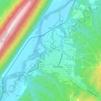
Nom : Carte topographique Valley, altitude, relief.
Altitude moyenne : 282 m
Altitude minimum : 191 m
Altitude maximum : 536 m
In 1972, the Baltimore and Ohio Railroad was merged into the Chessie System, which planned to close and abandon the South Branch line. The Romney spur through Depot Valley remained in service and was illustrated by the United States Geological Survey on its 1973 Romney Quadrangle topographic map. On October 11, 1978, the Chessie System transferred ownership of the South Branch line to the South Branch Valley Railroad, which in turn was owned and operated by the West Virginia State Rail Authority. During this transition, the Romney spur of the South Branch Valley Railroad was abandoned, after which all rail and commercial activity at Valley ceased.
Autres cartes topographiques
Cliquez sur une carte pour visualiser sa topographie, son altitude et son relief.
Romney Junction
United States > West Virginia > Hampshire County > Romney
Romney Junction, Romney, Hampshire County, West Virginia, 26757, United States
Altitude moyenne : 284 m