
Carte topographique Lakewood
Carte interactive
Cliquez sur la carte pour afficher l’altitude.
À propos de cette carte
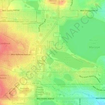
Nom : Carte topographique Lakewood, altitude, relief.
Lieu : Lakewood, Jefferson County, Colorado, United States (39.61832 -105.10995 39.63134 -105.06506)
Altitude moyenne : 1’695 m
Altitude minimum : 1’661 m
Altitude maximum : 1’728 m
Lakewood is located at 39°42′17″N 105°04′53″W / 39.70472°N 105.08139°W / 39.70472; -105.08139 at an elevation of 5,518 feet (1,682 m). Located at the junction of U.S. Route 6 and Colorado State Highway 121 in central Colorado, the city lies immediately west of Denver and 62 miles (100 km) north-northwest of Colorado Springs.