
Carte topographique Shanksville
Carte interactive
Cliquez sur la carte pour afficher l’altitude.
Shanksville
Shanksville is located at 40°1′2″N 78°54′21″W / 40.01722°N 78.90583°W / 40.01722; -78.90583 (40.017182, -78.905891), with the borough covering 0.2 square mile (0.5 km2), all land; it also has the seventh-highest elevation of boroughs in Pennsylvania at 2,230 feet (680 m).
À propos de cette carte
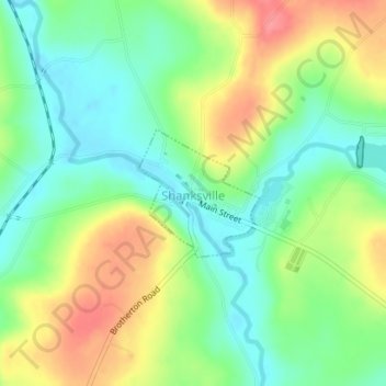
Nom : Carte topographique Shanksville, altitude, relief.
Altitude moyenne : 702 m
Altitude minimum : 670 m
Altitude maximum : 749 m