
Carte topographique Barragem da Crestuma-Lever
Carte interactive
Cliquez sur la carte pour afficher l’altitude.
Barragem da Crestuma-Lever
Crestuma–Lever Dam is a 25.5 m tall (height above foundation) and 470 m long gravity dam with a crest altitude of 25.5 m. The volume of the dam is 205,000 m³. The spillway with 8 gates is part of the dam body (maximum discharge 26,000 m³/s).
À propos de cette carte
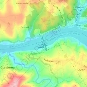
Nom : Carte topographique Barragem da Crestuma-Lever, altitude, relief.
Altitude moyenne : 72 m
Altitude minimum : 3 m
Altitude maximum : 173 m