
Carte topographique Ankeny
Carte interactive
Cliquez sur la carte pour afficher l’altitude.
Ankeny
Like most of Polk County, Ankeny exists at the bottom area of the Des Moines Lobe, a topographical landscape area, in an area known as the Bemis Advance. The Lobe was formed during the Wisconsin glaciation leaving significant deposits resulting in an area with low relief.
À propos de cette carte
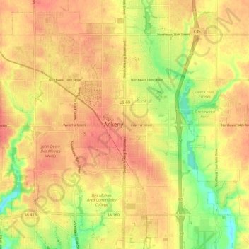
Nom : Carte topographique Ankeny, altitude, relief.
Lieu : Ankeny, Polk County, Iowa, 50023-3054, United States (41.69187 -93.64038 41.77187 -93.56038)
Altitude moyenne : 289 m
Altitude minimum : 255 m
Altitude maximum : 307 m