
Carte topographique Bullskin Township
Carte interactive
Cliquez sur la carte pour afficher l’altitude.
Bullskin Township
Bullskin Township is in northeastern Fayette County, bordered to the north by Westmoreland County. The eastern border of the township follows the crest of Chestnut Ridge, reaching elevations of 2,340 feet (710 m) above sea level. According to the United States Census Bureau, the township has a total area of 43.64 square miles (113.02 km2), of which 43.53 square miles (112.75 km2) is land and 0.11 square miles (0.272 km2), or 0.24%, is water.
À propos de cette carte
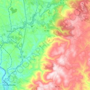
Nom : Carte topographique Bullskin Township, altitude, relief.
Altitude moyenne : 458 m
Altitude minimum : 258 m
Altitude maximum : 713 m
Autres cartes topographiques
Cliquez sur une carte pour visualiser sa topographie, son altitude et son relief.