Géolocaliser

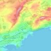
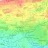
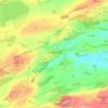
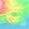
Carte topographique Falkland

Cliquez sur la carte pour afficher l’altitude.

À propos de cette carte

Nom : Carte topographique Falkland, altitude, relief.

Lieu : Falkland, Fife, Scotland, KY15 7BU, United Kingdom (56.23310 -3.22798 56.27310 -3.18798)

Altitude moyenne : 134 m

Altitude minimum : 37 m

Altitude maximum : 436 m

Autres cartes topographiques

Cliquez sur une carte pour visualiser sa topographie, son altitude et son relief.
Dunfermline

United Kingdom > Scotland > Fife > Dunfermline

Altitude moyenne : 80 m

Aberdour

United Kingdom > Scotland > Fife

Altitude moyenne : 77 m

Oakley

United Kingdom > Scotland > Fife

Altitude moyenne : 89 m

Loch Gelly

United Kingdom > Scotland > Fife > Lochgelly

Altitude moyenne : 124 m

Kinghorn

United Kingdom > Scotland > Fife

Altitude moyenne : 38 m

West Sands

United Kingdom > Scotland > Fife > St Andrews

Altitude moyenne : 2 m

East Burn

United Kingdom > Scotland > Fife > Kirkcaldy

Altitude moyenne : 44 m

Denett Burn

United Kingdom > Scotland > Fife > Anstruther

Altitude moyenne : 45 m

East Sands

United Kingdom > Scotland > Fife > St Andrews

Altitude moyenne : 19 m

Dunfermline

United Kingdom > Scotland > Fife

Altitude moyenne : 114 m

Inverkeithing

United Kingdom > Scotland > Fife

Topographically, Inverkeithing is situated on a raised terrace sloping down towards Inverkeithing Bay, which cuts in to the south of the town, separating it from the North Queensferry peninsula. Its medieval centre lay along High Street and Church Street, but the town has since expanded to encompass areas to…

Altitude moyenne : 28 m
Mossmorran Pond

United Kingdom > Scotland > Fife > Cowdenbeath

Altitude moyenne : 137 m

North Queensferry

United Kingdom > Scotland > Fife

Altitude moyenne : 9 m

Rosyth

United Kingdom > Scotland > Fife

Altitude moyenne : 23 m

Auchtertool

United Kingdom > Scotland > Fife

Altitude moyenne : 113 m

Burntisland

United Kingdom > Scotland > Fife

Altitude moyenne : 49 m

Townhill Wood

United Kingdom > Scotland > Fife > Dunfermline > Townhill

Altitude moyenne : 138 m

Cameron Reservoir

United Kingdom > Scotland > Fife

Altitude moyenne : 156 m

Inchkeith

United Kingdom > Scotland > Fife > Burntisland

Altitude moyenne : 1 m

Kinghorn Loch

United Kingdom > Scotland > Fife > Kinghorn

Altitude moyenne : 64 m

Inchcolm

United Kingdom > Scotland > Fife

Altitude moyenne : 1 m

Loch Ore

United Kingdom > Scotland > Fife > Glencraig > Lochcraig

Altitude moyenne : 114 m

Isle of May

United Kingdom > Scotland > Fife

Altitude moyenne : 1 m

Loch Fitty

United Kingdom > Scotland > Fife > Kelty

Altitude moyenne : 152 m

Inverkeithing

United Kingdom > Scotland > Fife

Topographically, Inverkeithing is situated on a raised terrace sloping down towards Inverkeithing Bay, which cuts into the south of the town, separating it from the North Queensferry Peninsula. The town is bounded to the west by Castlandhill and to the east by Letham Hill, a 324 ft coastal hill and woodland.

Altitude moyenne : 28 m
Dunfermline

United Kingdom > Scotland > Fife

Altitude moyenne : 114 m

Kinghorn

United Kingdom > Scotland > Fife

Altitude moyenne : 38 m

Silver Sands

United Kingdom > Scotland > Fife > Aberdour

Altitude moyenne : 34 m

Rosyth

United Kingdom > Scotland > Fife

Altitude moyenne : 23 m

Burntisland

United Kingdom > Scotland > Fife

Altitude moyenne : 49 m

Dunfermline

United Kingdom > Scotland > Fife

Altitude moyenne : 114 m

Équipez-vous pour votre prochaine aventure :

🕶️Lunettes de glacier - Protection maximale contre les rayons UV intenses sur la neige
🧢Casquettes et couvre-chefs outdoor - Protection solaire et thermique en extérieur
🎿Housse de transport skis - Protégez votre matériel lors de vos déplacements en train ou voiture
🍯Barres énergétiques - Coup de boost rapide lors des ascensions difficiles
🥫Plats lyophilisés - Repas légers et énergétiques pour l'autonomie totale

En tant que Partenaire Amazon, ce site perçoit une commission sur les achats éligibles sans surcoût pour vous.