
Carte topographique Olivos
Carte interactive
Cliquez sur la carte pour afficher l’altitude.
Olivos
Olivos is located on the western bank of the Río de la Plata, the world's widest river. The river is approximately 50 km (31 mi) wide at Olivos, and as such, Uruguay is not visible from ground level. However, Olivos (and this entire region of the Rio) do not have sandy beaches; the shoreline is relatively rocky. Comparable shorelines include those of the Great Lakes in North America. The city's topography is relatively flat. However, there are some ridges by the river towards the north, in the La Lucila neighbourhood.
À propos de cette carte
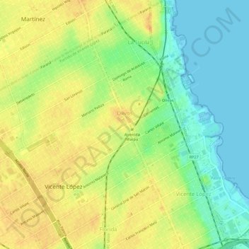
Nom : Carte topographique Olivos, altitude, relief.
Altitude moyenne : 17 m
Altitude minimum : -2 m
Altitude maximum : 31 m