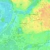
Carte topographique Navy Point
Cliquez sur la carte pour afficher l’altitude.
À propos de cette carte

Nom : Carte topographique Navy Point, altitude, relief.
Lieu : Navy Point, Escambia County, Florida, 32512, United States (30.35992 -87.31331 30.39992 -87.27331)
Altitude moyenne : 8 m
Altitude minimum : -5 m
Altitude maximum : 18 m
Autres cartes topographiques
Cliquez sur une carte pour visualiser sa topographie, son altitude et son relief.
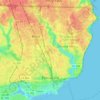
Pensacola
United States > Florida > Escambia County
The land is sloped up northward from Pensacola Bay, with most of the city at an elevation above that which a potential hurricane storm surge could affect.
Altitude moyenne : 21 m
Pensacola
United States > Florida > Escambia County
Pensacola features a diverse topography characterized primarily by its proximity to the Gulf of Mexico and the sheltered Pensacola Bay. The terrain gently slopes upward from the waterfront, resulting in a gradual elevation that provides natural protection against storm surges, making it somewhat less…
Altitude moyenne : 21 m
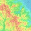
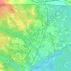


West Pensacola
United States > Florida > Escambia County
West Pensacola is located approximately 4 miles (6 km) west of downtown Pensacola. The elevation of the CDP is 76 feet above sea level.
Altitude moyenne : 20 m


Pensacola
United States > Florida > Escambia County
The land is sloped up northward from Pensacola Bay, with most of the city at an elevation above that at which a potential hurricane storm surge could affect.
Altitude moyenne : 21 m

Pensacola
United States > Florida > Escambia County
The land is sloped up northward from Pensacola Bay, with most of the city at an elevation above that which a potential hurricane storm surge could affect.
Altitude moyenne : 21 m
Pensacola
United States > Florida > Escambia County
The land is sloped up northward from Pensacola Bay, with most of the city at an elevation above that at which a potential hurricane storm surge could affect.
Altitude moyenne : 21 m
Pensacola
United States > Florida > Escambia County
The land is sloped up northward from Pensacola Bay, with most of the city at an elevation above that at which a potential hurricane storm surge could affect.
Altitude moyenne : 21 m

Pensacola
United States > Florida > Escambia County
The land is sloped up northward from Pensacola Bay, with most of the city at an elevation above that at which a potential hurricane storm surge could affect.
Altitude moyenne : 21 m