
Carte topographique Filband
Carte interactive
Cliquez sur la carte pour afficher l’altitude.
À propos de cette carte
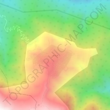
Nom : Carte topographique Filband, altitude, relief.
Altitude moyenne : 1’923 m
Altitude minimum : 1’333 m
Altitude maximum : 2’597 m
This village is located at an altitude of about 2,300 metres above sea level. Filband on the eastern side of Mazandaran is known as the roof of the province.