
Carte topographique Churchtown-Orwell ED
Carte interactive
Cliquez sur la carte pour afficher l’altitude.
À propos de cette carte
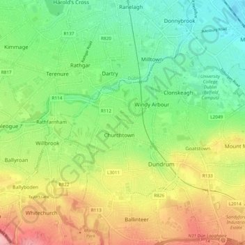
Nom : Carte topographique Churchtown-Orwell ED, altitude, relief.
Altitude moyenne : 54 m
Altitude minimum : -1 m
Altitude maximum : 135 m
Autres cartes topographiques
Cliquez sur une carte pour visualiser sa topographie, son altitude et son relief.
Rathfarnham
Rathfarnham, Churchtown-Castle ED, Dublin 14, Dún Laoghaire-Rathdown, County Dublin, Leinster, DUBLIN 14, Ireland
Altitude moyenne : 56 m