
Carte topographique Whitwick
Cliquez sur la carte pour afficher l’altitude.
À propos de cette carte
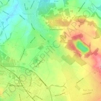
Nom : Carte topographique Whitwick, altitude, relief.
Altitude moyenne : 152 m
Altitude minimum : 95 m
Altitude maximum : 218 m
Autres cartes topographiques
Cliquez sur une carte pour visualiser sa topographie, son altitude et son relief.
Thringstone
United Kingdom > England > Leicestershire > North West Leicestershire
Altitude moyenne : 126 m
Oakthorpe
United Kingdom > England > Leicestershire > North West Leicestershire
Altitude moyenne : 94 m
Kelham Bridge Nature Reserve
United Kingdom > England > Leicestershire > North West Leicestershire > Ravenstone
Altitude moyenne : 139 m
Coalville
United Kingdom > England > Leicestershire > North West Leicestershire
Altitude moyenne : 149 m
Isley Walton
United Kingdom > England > Leicestershire > North West Leicestershire
Altitude moyenne : 76 m
Lount Wood
United Kingdom > England > Leicestershire > North West Leicestershire > Lount
Altitude moyenne : 131 m
Breedon on the Hill
United Kingdom > England > Leicestershire > North West Leicestershire
Altitude moyenne : 84 m
Ravenstone
United Kingdom > England > Leicestershire > North West Leicestershire
Altitude moyenne : 143 m
Nailstone Colliery Railway
United Kingdom > England > Leicestershire > North West Leicestershire > Ibstock
Altitude moyenne : 155 m
Sence Valley Country Park
United Kingdom > England > Leicestershire > North West Leicestershire > Heather
Altitude moyenne : 131 m
Long Whatton
United Kingdom > England > Leicestershire > North West Leicestershire
Altitude moyenne : 63 m
Timberwood Hill
United Kingdom > England > Leicestershire > North West Leicestershire
Altitude moyenne : 192 m
Breedon Cloud Wood
United Kingdom > England > Leicestershire > North West Leicestershire > Breedon on the Hill
Altitude moyenne : 90 m
Swannymote Rock
United Kingdom > England > Leicestershire > North West Leicestershire > Coalville
Altitude moyenne : 139 m
Willesley Woods
United Kingdom > England > Leicestershire > North West Leicestershire > Ashby-de-la-Zouch > Willesley
Altitude moyenne : 108 m
Kegworth
United Kingdom > England > Leicestershire > North West Leicestershire
Altitude moyenne : 47 m
Diseworth
United Kingdom > England > Leicestershire > North West Leicestershire
Altitude moyenne : 77 m
Hugglescote
United Kingdom > England > Leicestershire > North West Leicestershire
Altitude moyenne : 154 m
Bardon Hill
United Kingdom > England > Leicestershire > North West Leicestershire
Altitude moyenne : 199 m
Ashby de la Zouch Canal
United Kingdom > England > Leicestershire > North West Leicestershire > Moira
Altitude moyenne : 100 m
Lockington
United Kingdom > England > Leicestershire > North West Leicestershire
Altitude moyenne : 47 m
Albert Village
United Kingdom > England > Leicestershire > North West Leicestershire
Altitude moyenne : 113 m
Oaks in Charnwood
United Kingdom > England > Leicestershire > North West Leicestershire
Altitude moyenne : 155 m
Ellistown
United Kingdom > England > Leicestershire > North West Leicestershire
Altitude moyenne : 153 m
Donington Le Heath
United Kingdom > England > Leicestershire > North West Leicestershire
Altitude moyenne : 148 m
Shellbrook
United Kingdom > England > Leicestershire > North West Leicestershire > Ashby-de-la-Zouch > Blackfordby
Altitude moyenne : 128 m
Donisthorpe
United Kingdom > England > Leicestershire > North West Leicestershire
From: A Topographical Dictionary of England, published by S Lewis, London, 1848.
Altitude moyenne : 94 m
Cademan Wood
United Kingdom > England > Leicestershire > North West Leicestershire > Whitwick
Altitude moyenne : 138 m
Ashby de la Zouch Canal
United Kingdom > England > Leicestershire > North West Leicestershire > Oakthorpe
Altitude moyenne : 97 m
Newbold
United Kingdom > England > Leicestershire > North West Leicestershire
Altitude moyenne : 114 m
Peggs Green
United Kingdom > England > Leicestershire > North West Leicestershire > Peggs Green
Altitude moyenne : 121 m
Griffydam
United Kingdom > England > Leicestershire > North West Leicestershire
Altitude moyenne : 111 m
Farmtown
United Kingdom > England > Leicestershire > North West Leicestershire > Coleorton
Altitude moyenne : 141 m
Willesley
United Kingdom > England > Leicestershire > North West Leicestershire
Altitude moyenne : 110 m
Coalville
United Kingdom > England > Leicestershire > North West Leicestershire
Altitude moyenne : 149 m
Coalville
United Kingdom > England > Leicestershire > North West Leicestershire
Altitude moyenne : 149 m
Coalville
United Kingdom > England > Leicestershire > North West Leicestershire
Altitude moyenne : 149 m
Coalville
United Kingdom > England > Leicestershire > North West Leicestershire
Altitude moyenne : 149 m
Isley Walton
United Kingdom > England > Leicestershire > North West Leicestershire
Altitude moyenne : 76 m