
Carte topographique Cerro de Punta
Carte interactive
Cliquez sur la carte pour afficher l’altitude.
À propos de cette carte
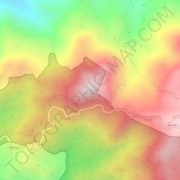
Nom : Carte topographique Cerro de Punta, altitude, relief.
Lieu : Cerro de Punta, Ponce, Puerto Rico, 00654, United States (18.17218 -66.59177 18.17228 -66.59167)
Altitude moyenne : 1’021 m
Altitude minimum : 623 m
Altitude maximum : 1’309 m
The mountain is part of the Cordillera Central and is located on the border between the municipalities of Jayuya and Ponce. The access road to the point closest to the highest elevation is from the municipality of Jayuya. It is part of the Toro Negro Forest Reserve, and it has been described as "an alpine runt." It is located on the western end of the Toro Negro State Park. The mountain is just north of east-to-westbound Route 143. It is located at coordinates 18.172458 and -66.591839W. The nearest populated place to Cerro de Punta is Urbanización Vega Linda, located 3.3 miles (5.3 km) away.
Autres cartes topographiques
Cliquez sur une carte pour visualiser sa topographie, son altitude et son relief.
Anón
United States > Puerto Rico > Ponce
Anón, Ponce, Puerto Rico, United States
Altitude moyenne : 669 m
Maragüez
United States > Puerto Rico > Ponce
Maragüez, Ponce, Puerto Rico, United States
Altitude moyenne : 322 m