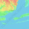
Carte topographique Navarre
Cliquez sur la carte pour afficher l’altitude.
Navarre
As a low-elevation community near the Gulf of Mexico, Navarre is often threatened by hurricanes. Significant damage was incurred as a result of hurricanes Erin and Opal in 1995, Georges in 1998, Ivan in 2004, Dennis in 2005 and Sally in 2020. Many homes and businesses immediately along Santa Rosa Sound (generally south of U.S. Highway 98) suffered storm surge as a result of those storms. Recoveries have been rendered by the area with the population quickly flourishing. This area of Florida is consistently listed as one of the worst places for hurricanes.
À propos de cette carte
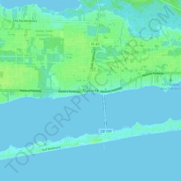
Nom : Carte topographique Navarre, altitude, relief.
Lieu : Navarre, Santa Rosa County, Florida, 32566, United States (30.36198 -86.91008 30.44198 -86.83008)
Altitude moyenne : 4 m
Altitude minimum : -4 m
Altitude maximum : 25 m
Autres cartes topographiques
Cliquez sur une carte pour visualiser sa topographie, son altitude et son relief.