Géolocaliser

Carte topographique Mount Leo

Cliquez sur la carte pour afficher l’altitude.

À propos de cette carte

Nom : Carte topographique Mount Leo, altitude, relief.

Lieu : Mount Leo, Snowy Monaro Regional Council, New South Wales, 2625, Australia (-36.53578 148.33213 -36.53568 148.33223)

Altitude moyenne : 1’780 m

Altitude minimum : 1’634 m

Altitude maximum : 1’917 m

Autres cartes topographiques

Cliquez sur une carte pour visualiser sa topographie, son altitude et son relief.
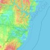
Sydney

Australia > New South Wales

Sydney's topography is characterized by a diverse landscape that seamlessly blends coastal features with inland plateaus. The city is divided into two primary regions: the relatively flat Cumberland Plain to the south and west of Sydney Harbour, and the elevated Hornsby Plateau to the north. The Cumberland…

Altitude moyenne : 51 m
Barrington Tops

Australia > New South Wales

Altitude moyenne : 1’107 m

Bowral

Australia > New South Wales

Altitude moyenne : 690 m

Newcastle

Australia > New South Wales > Newcastle

Altitude moyenne : 5 m

Yass

Australia > New South Wales

Yass is located 280 km south-west of Sydney, on the Hume Highway. The Yass River, which is a tributary of the Murrumbidgee River, flows through the town. Yass is 59 km from Canberra; lying at an elevation of 505 m AMSL.

Altitude moyenne : 533 m

Iluka

Australia > New South Wales

Altitude moyenne : 2 m

Byron Bay

Australia > New South Wales

Byron Bay, located in northeastern New South Wales, Australia, is characterized by diverse topography shaped by its geological history. The town is part of the erosion caldera of the ancient Tweed Volcano, which erupted approximately 23 million years ago, resulting in the rich volcanic soils that define the…

Altitude moyenne : 7 m
Castle Hill

Australia > New South Wales

Altitude moyenne : 123 m

Wootton

Australia > New South Wales

Altitude moyenne : 102 m

Port Macquarie

Australia > New South Wales

Altitude moyenne : 5 m

Lindfield

Australia > New South Wales > Sydney

Altitude moyenne : 79 m

Kurrajong Heights

Australia > New South Wales > Sydney

Altitude moyenne : 385 m

Wauchope

Australia > New South Wales

Altitude moyenne : 32 m

Gulmarrad

Australia > New South Wales

Altitude moyenne : 10 m

Abermain

Australia > New South Wales

Altitude moyenne : 57 m

Luddenham

Australia > New South Wales

Altitude moyenne : 72 m

Orange

Australia > New South Wales

Orange is a city in the Central Tablelands region of New South Wales, Australia. It is 254 km (158 mi) west of the state capital, Sydney [206 km (128 mi) on a great circle], at an altitude of 862 metres (2,828 ft). Orange had an estimated urban population of 40,493 as of June 2018 making the city a significant…

Altitude moyenne : 852 m

Woodstock

Australia > New South Wales

Altitude moyenne : 501 m

Shelly Beach

Australia > New South Wales

Altitude moyenne : 9 m

Bucca

Australia > New South Wales

Altitude moyenne : 122 m

Majors Creek

Australia > New South Wales

Altitude moyenne : 648 m

Girvan

Australia > New South Wales

Altitude moyenne : 99 m

Casino

Australia > New South Wales

Altitude moyenne : 32 m

Glen Innes

Australia > New South Wales

Altitude moyenne : 1’083 m

Blackheath

Australia > New South Wales

Blackheath (postcode: 2785) is an Australian town located near the highest point of the Blue Mountains, between Katoomba and Mount Victoria in New South Wales. The town's altitude is about 1,065 metres (3,494 ft) AHD  and it is located about 120 kilometres (75 mi) west north-west of Sydney, 11 kilometres…

Altitude moyenne : 893 m
Moss Vale

Australia > New South Wales

Altitude moyenne : 673 m

Pittwater

Australia > New South Wales

Altitude moyenne : 45 m

Mudgee

Australia > New South Wales

Altitude moyenne : 535 m

Ourimbah

Australia > New South Wales

Altitude moyenne : 84 m

North Rothbury

Australia > New South Wales

Altitude moyenne : 66 m

Wentworth Falls

Australia > New South Wales > Sydney

Wentworth Falls (postcode: 2782) is a town in the Blue Mountains region of New South Wales, situated approximately 100 kilometres (62 mi) west of the Sydney central business district, and about 8 kilometres (5.0 mi) east of Katoomba, Australia on the Great Western Highway, with a Wentworth Falls railway…

Altitude moyenne : 708 m

Lower Portland

Australia > New South Wales

Altitude moyenne : 67 m

Sydney

Australia > New South Wales > Sydney

Altitude moyenne : 23 m

Wagga Wagga

Australia > New South Wales

Altitude moyenne : 183 m

Carrington

Australia > New South Wales > Newcastle

Altitude moyenne : 3 m

Stuart Town

Australia > New South Wales

Altitude moyenne : 547 m

Timbarra

Australia > New South Wales

Altitude moyenne : 810 m

Mount Fairy

Australia > New South Wales

Altitude moyenne : 767 m

Lochiel

Australia > New South Wales

Altitude moyenne : 135 m

Ourimbah Creek

Australia > New South Wales

Altitude moyenne : 131 m

Hunterview

Australia > New South Wales

Altitude moyenne : 61 m

Blue Mountains

Australia > New South Wales

A sandstone plateau dominated by a landscape of endless eucalyptus forests, the Blue Mountains are located at the top of a 470-million-year-old quartzite. In the Permian period, a shallow sea covered the region, when rivers brought shales, siltstones and mudstones. Then during the Mesozoic period, rivers…

Altitude moyenne : 566 m

Tilligerry Creek

Australia > New South Wales

Altitude moyenne : 3 m

Racecourse Creek

Australia > New South Wales

Altitude moyenne : 5 m

Arrawarra Headland

Australia > New South Wales

Altitude moyenne : 6 m

Sassafras

Australia > New South Wales

Altitude moyenne : 660 m

Craigie

Australia > New South Wales

Altitude moyenne : 815 m

Canowindra

Australia > New South Wales

Altitude moyenne : 414 m

Delegate

Australia > New South Wales

Altitude moyenne : 841 m

Mannering Park

Australia > New South Wales

Altitude moyenne : 11 m

Geneva

Australia > New South Wales

Altitude moyenne : 95 m

Moruya

Australia > New South Wales

Altitude moyenne : 37 m

Calderwood

Australia > New South Wales

Altitude moyenne : 100 m

Elsmore

Australia > New South Wales

Altitude moyenne : 730 m

Parramatta

Australia > New South Wales

Altitude moyenne : 22 m

Armidale

Australia > New South Wales

Altitude moyenne : 1’036 m

Brindabella

Australia > New South Wales

Altitude moyenne : 970 m

Medlow Bath

Australia > New South Wales

Medlow Bath (postcode: 2780) is an Australian small town located near the highest point of the Blue Mountains, between Katoomba and Blackheath. Its altitude is about 1,050 metres (3,440 ft) AHD  and it is about 115 kilometres (71 mi) west-north-west of the Sydney central business district and 5 kilometres…

Altitude moyenne : 930 m

Bossley Park

Australia > New South Wales

Altitude moyenne : 55 m

Illawarra

Australia > New South Wales

Altitude moyenne : 234 m

Bullocks Flat

Australia > New South Wales

Altitude moyenne : 1’197 m

Ryde

Australia > New South Wales > Sydney

Altitude moyenne : 52 m

Bonalbo

Australia > New South Wales

Altitude moyenne : 263 m

Northern Beaches

Australia > New South Wales > Sydney

Altitude moyenne : 67 m

Lower North Shore

Australia > New South Wales > Sydney

Altitude moyenne : 45 m

Black Springs

Australia > New South Wales

Altitude moyenne : 1’157 m

Sunny Corner

Australia > New South Wales

Altitude moyenne : 1’119 m

Macleay River

Australia > New South Wales

Altitude moyenne : 308 m

Manly Dam

Australia > New South Wales > Sydney

Altitude moyenne : 51 m

Boxers Creek

Australia > New South Wales

Altitude moyenne : 689 m

Diehard

Australia > New South Wales

Altitude moyenne : 816 m

Mount George

Australia > New South Wales

Altitude moyenne : 180 m

Oxley Island

Australia > New South Wales

Altitude moyenne : 4 m

Central Coast Council

Australia > New South Wales

Altitude moyenne : 103 m

Lake Munmorah

Australia > New South Wales

Altitude moyenne : 10 m

Goobarragandra

Australia > New South Wales

Altitude moyenne : 877 m

Scotts Head

Australia > New South Wales

Altitude moyenne : 5 m

Goulburn

Australia > New South Wales

Owing to its elevation, Goulburn has an oceanic climate (Cfb) with warm summers and cool winters; with a high diurnal range. Its climate is variable much of the year, though generally dry with maximum temperatures ranging from 11.8 °C (53.2 °F) in July to 28.3 °C (82.9 °F) in January. Rainfall is…

Altitude moyenne : 666 m
Randwick

Australia > New South Wales > Sydney

Altitude moyenne : 44 m

Liverpool

Australia > New South Wales > Sydney

Altitude moyenne : 14 m

Mollymook

Australia > New South Wales

Altitude moyenne : 24 m

Woy Woy

Australia > New South Wales

Altitude moyenne : 35 m

Woolgoolga

Australia > New South Wales

Altitude moyenne : 29 m

Campsie

Australia > New South Wales

Altitude moyenne : 22 m

Taree

Australia > New South Wales

Altitude moyenne : 17 m

Bega

Australia > New South Wales

Altitude moyenne : 44 m

Skennars Head

Australia > New South Wales

Altitude moyenne : 8 m

Équipez-vous pour votre prochaine aventure :

🍽️Popotes de camping - Ustensiles légers pour repas en bivouac
🧱Matelas de camping - Matelas isolants pour nuits en plein air
💡Lanterne de tente - Éclairage d'ambiance pour vos soirées sous les étoiles
🧊Sac isotherme léger - Gardez vos provisions au frais pendant vos marches d'été
🔭Jumelles de randonnée - Compactes et légères pour observer le relief et la faune des Alpes

En tant que Partenaire Amazon, ce site perçoit une commission sur les achats éligibles sans surcoût pour vous.