
Carte topographique Abrantes
Carte interactive
Cliquez sur la carte pour afficher l’altitude.
À propos de cette carte
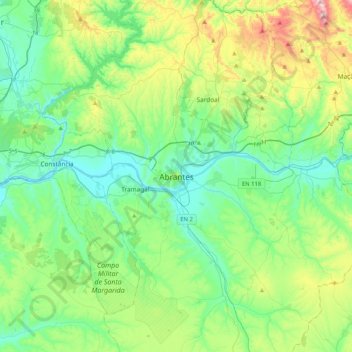
Nom : Carte topographique Abrantes, altitude, relief.
Altitude moyenne : 162 m
Altitude minimum : 11 m
Altitude maximum : 612 m
An active republican center, Abrantes was the place of preparatory meetings for the 5 October 1910 Revolution, which may have contributed to the village's elevation to the status of city on 14 June 1916.