
Carte topographique Govardhan
Carte interactive
Cliquez sur la carte pour afficher l’altitude.
À propos de cette carte
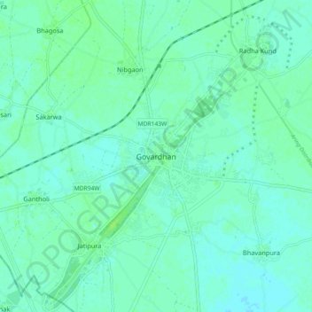
Nom : Carte topographique Govardhan, altitude, relief.
Altitude moyenne : 181 m
Altitude minimum : 177 m
Altitude maximum : 188 m
Govardhana is located at 27°30′N 77°28′E / 27.5°N 77.47°E / 27.5; 77.47. It has an average elevation of 179 metres (587 feet). Govardhana has been made Tehsil in Mathura District by the Uttar Pradesh government.
Autres cartes topographiques
Cliquez sur une carte pour visualiser sa topographie, son altitude et son relief.
Mathura
India > Uttar Pradesh > Mathura
Mathura, Agra division, Uttar Pradesh, 281001, India
Altitude moyenne : 177 m