
Carte topographique Osbaldwick
Carte interactive
Cliquez sur la carte pour afficher l’altitude.
À propos de cette carte
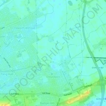
Nom : Carte topographique Osbaldwick, altitude, relief.
Lieu : Osbaldwick, York, England, United Kingdom (53.95377 -1.04702 53.97480 -1.01752)
Altitude moyenne : 16 m
Altitude minimum : 10 m
Altitude maximum : 32 m
Autres cartes topographiques
Cliquez sur une carte pour visualiser sa topographie, son altitude et son relief.
Stockton-on-the-Forest
United Kingdom > England > York
Stockton-on-the-Forest, York, England, United Kingdom
Altitude moyenne : 22 m
Dunnington
United Kingdom > England > York > Dunnington
Dunnington, York, Yorkshire and the Humber, England, United Kingdom
Altitude moyenne : 15 m