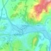
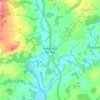
Carte topographique Brecon Beacons
Cliquez sur la carte pour afficher l’altitude.
À propos de cette carte

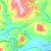
Nom : Carte topographique Brecon Beacons, altitude, relief.
Lieu : Brecon Beacons, Powys, Wales, United Kingdom (51.86624 -3.44365 51.88405 -3.36385)
Altitude moyenne : 560 m
Altitude minimum : 257 m
Altitude maximum : 880 m
Autres cartes topographiques
Cliquez sur une carte pour visualiser sa topographie, son altitude et son relief.


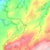
Knighton
United Kingdom > Wales > Powys
The town became a borough in 1203, with a charter permitting a weekly market and annual fair. The presence of two castles within a comparatively small town suggests that one (the earlier motte and bailey sited atop the town) went out of use before the establishment of the second (the motte with no bailey at…
Altitude moyenne : 295 m
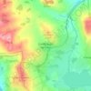
Welshpool
United Kingdom > Wales > Powys
The Mermaid Inn, 28 High Street, was very probably an early 16th-century merchant's house, placed on a burgage plot between the High Street and Alfred Jones Court. The timber-framed building has long storehouse or wing to the rear. The frontage was remodelled c. 1890, by Frank H. Shayler, architect, of…
Altitude moyenne : 156 m

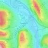
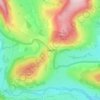
Brecon Beacons National Park
United Kingdom > Wales > Powys
Brecon Beacons National Park, officially named Bannau Brycheiniog National Park (Welsh pronunciation), is a national park in Wales. It is named after the Brecon Beacons (Welsh: Bannau Brycheiniog), the mountain range at its centre. The national park includes the highest mountain in South Wales, Pen y Fan,…
Altitude moyenne : 270 m








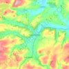








Aber Rhaeadr
United Kingdom > Wales > Powys > Llanrhaeadr-ym-Mochnant > Aber Rhaeadr
Altitude moyenne : 193 m