
Carte topographique Purulia - II
Carte interactive
Cliquez sur la carte pour afficher l’altitude.
À propos de cette carte
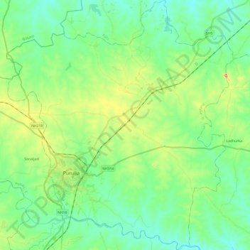
Nom : Carte topographique Purulia - II, altitude, relief.
Lieu : Purulia - II, Puruliya, West Bengal, India (23.26134 86.30520 23.48135 86.52287)
Altitude moyenne : 230 m
Altitude minimum : 184 m
Altitude maximum : 354 m
The Purulia II CD block is located in the central part of the district. The Kangsabati River forms the boundary between the Purulia II and Purulia I CD blocks. The upper Kangsabati basin has undulating land and the elevation rises from 200 to 300 m and the general slope is from west to east and south-east.
Autres cartes topographiques
Cliquez sur une carte pour visualiser sa topographie, son altitude et son relief.
Purulia
India > West Bengal > Purulia - II
Purulia, Purulia - II, Puruliya, West Bengal, 723101, India
Altitude moyenne : 241 m