

Carte topographique Mirzapur
Cliquez sur la carte pour afficher l’altitude.
Mirzapur
Mirzapur is located at 25°09′N 82°35′E / 25.15°N 82.58°E / 25.15; 82.58. It has an average elevation of 80 metres (265 feet). The District of Mirzapur lies between the parallels of 23.52 & 25.32 North latitude and 82.7 and 83.33 East longitude. It forms a portion of the Varanasi district. On the north and north-east it is bounded by the Varanasi district; on the south bounded by Sonbhadra district; on the north-west by Allahabad district. The shape to the north and west is totally regular. In no direction, except for about 13 km. in the north-east where the Ganges separates the Tehsil of Chunar from the district of Varanasi, has Mirzapur a natural frontier. The Chanvar fields, considered to be one of the most fertile lands tracts in India, are located on Gangetic flood plains of the district. Also, Indian Standard Time is calculated on the basis of 82.5° E longitude, from a clock tower in Mirzapur
À propos de cette carte
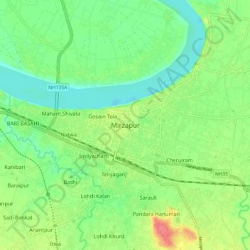
Nom : Carte topographique Mirzapur, altitude, relief.
Lieu : Mirzapur, Uttar Pradesh, 231001, India (25.10613 82.52900 25.18613 82.60900)
Altitude moyenne : 83 m
Altitude minimum : 60 m
Altitude maximum : 122 m