
Carte topographique Providence Island
Carte interactive
Cliquez sur la carte pour afficher l’altitude.
Providence Island
Providencia's maximum elevation is 360 metres (1,180 ft) above sea level. The smaller Santa Catalina Island to the northwest is connected by a 100-metre (330 ft) footbridge to its larger sister Providencia Island. Providencia Island has an area of 17 square kilometres (6.6 sq mi); the two islands cover an area of 22 square kilometres (8.5 sq mi) and form the municipality of Santa Isabel, which had a population of 4,927 at the Census of 2005. The island is served by El Embrujo Airport, which the Colombian Government plans to expand in order to take international flights.
À propos de cette carte
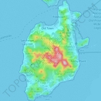
Nom : Carte topographique Providence Island, altitude, relief.
Altitude moyenne : 33 m
Altitude minimum : 0 m
Altitude maximum : 345 m
Autres cartes topographiques
Cliquez sur une carte pour visualiser sa topographie, son altitude et son relief.